Scotland 2015: Day 19
Day 19. Today is day 19! Every time I reflect on the chaos that is the trip I end up spending so much time talking about Day 19!
I’m going to have skip Hadrian’s Wall – it’s technically England anyway. But I’m gonna do my damnedest to get these prints done! Anyways, it’s NOT raining. Now it’s too sunny. I am having a little bit of a late start because got a good nights sleep – finally a good bed. Also, I’m tired – not of the adventure – just physically tired 🙂 Only a few more days left – time to push on!!!

Started with a very yummy if not overpriced breakfast. The premise is that I’m gonna run as much as I can which means breakfast and dinner but probably no lunch.
Technically today is the worst day of the entire trip. I have something like 10 prints that I could see in the area and my research on them is VERY very spotty. One of my best resources this entire trip has been CANMORE – National Record of the Historic Environment but some of these prints are very very esoteric.
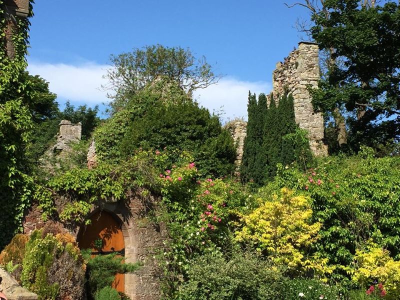
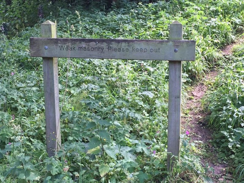
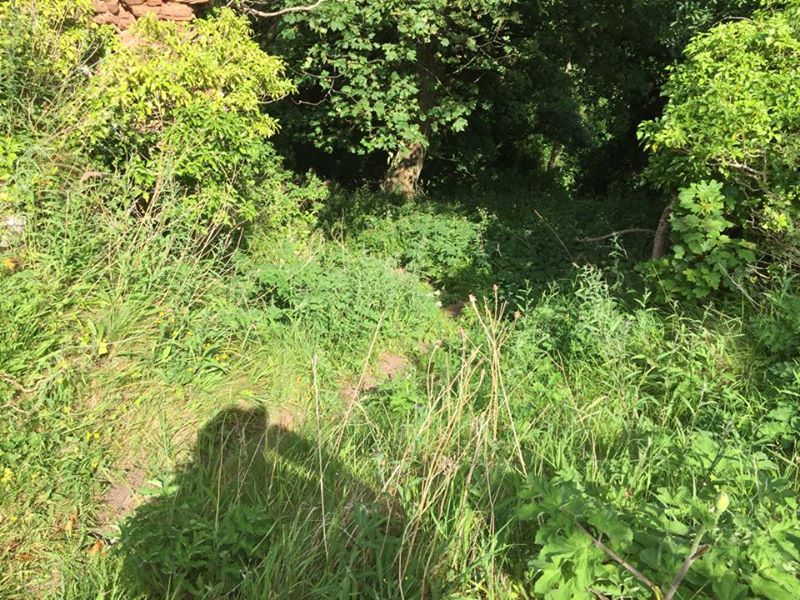
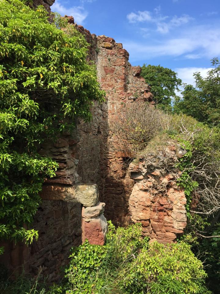
North Berwick is tricky as I have 4 prints from here and very little is a definitive. 2 of the prints are marked North Berwick Nunnery and one says North Berwick Monastery and that one looks very ruined and NOTHING like the other two prints. In my research I found that in the middle of the ‘burbs there is an Abbey Street and a Nunsgate Street and between these two there is an old age home called the Abbey Home or something like that. You can see nothing from the road. You can’t even see the big hill (called North Berwick which you will see in a moment). Using Google street view and Google Earth each I saw glimpses of something. I rang the bell and explained my situation and they took me in and showed me what was left! Some interesting ruins. From the courtyard you can see some ruins but from the outside it is covered by shrubs, trees, and fences.
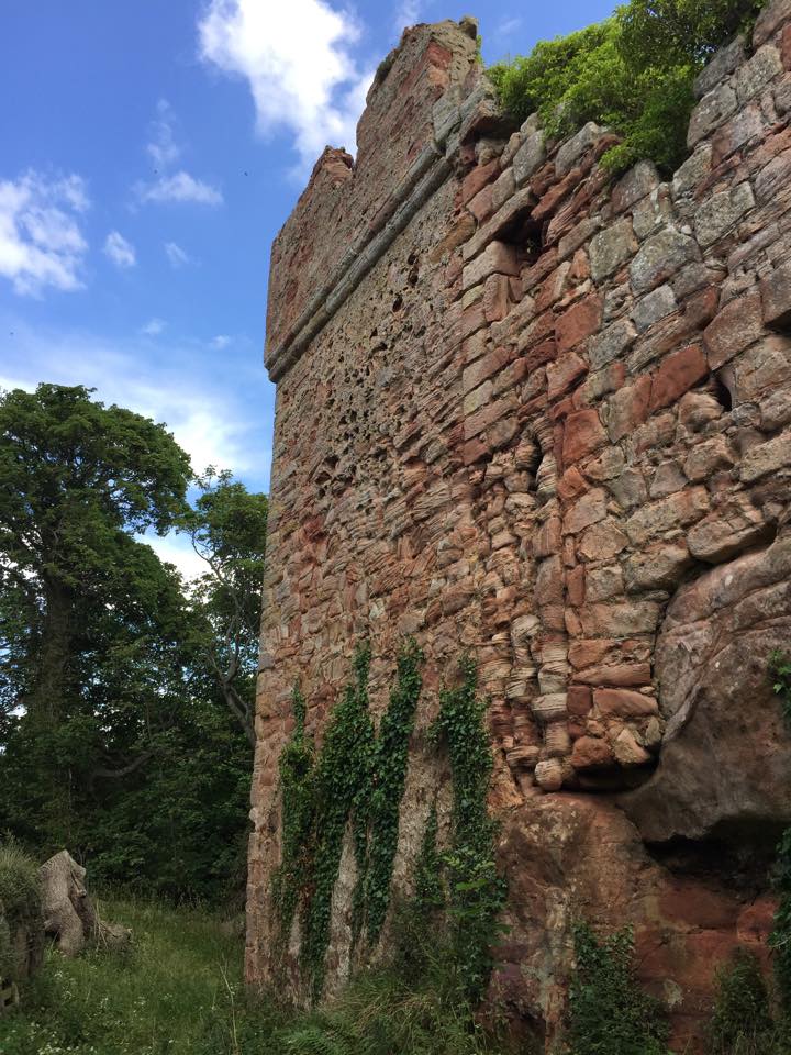
On the outside between the shrubs and bushes and trees I was able to verify one of the two views! Obviously I am shooting from a very weird angle. Church #24 – Print #25 – North Berwick Nunnery.
Now a 2018 update. I don’t give up easily! I have 2 views titled North Berwick Nunnery and while they don’t look anything alike, the CANMORE website verifies that I am in the correct location and has much earlier photographs than mine than match the prints. So it is all about point of view.

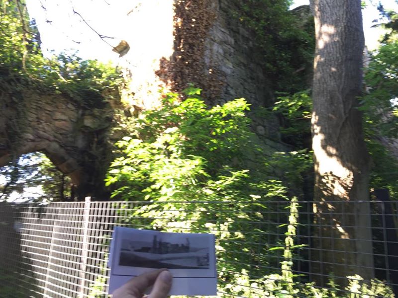
Looking at Print #25, the one that I verified, you can see that I am standing closest to the road, north of the Nunnery facing south. The yellow arrow indicates the round tower area and the red arrow the tallest part of the wall.
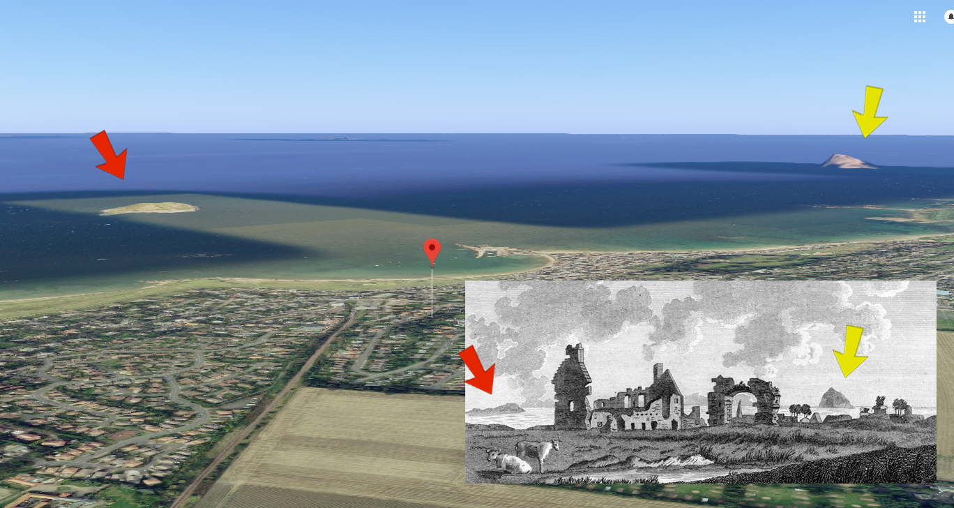
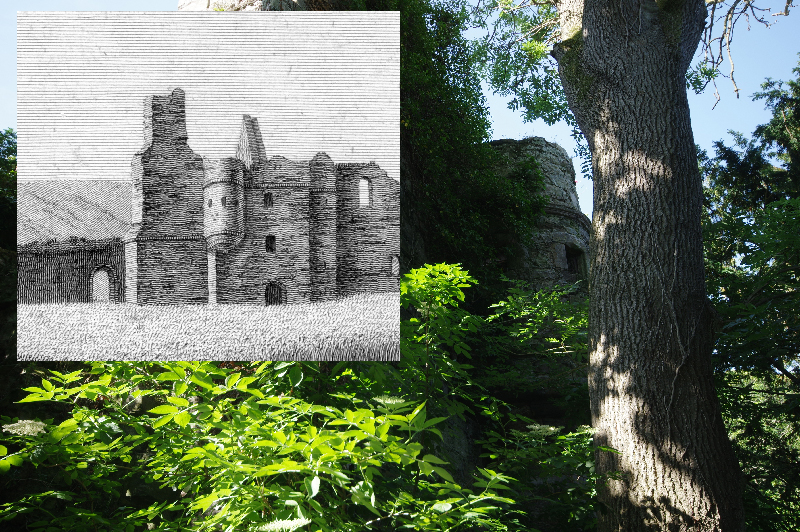
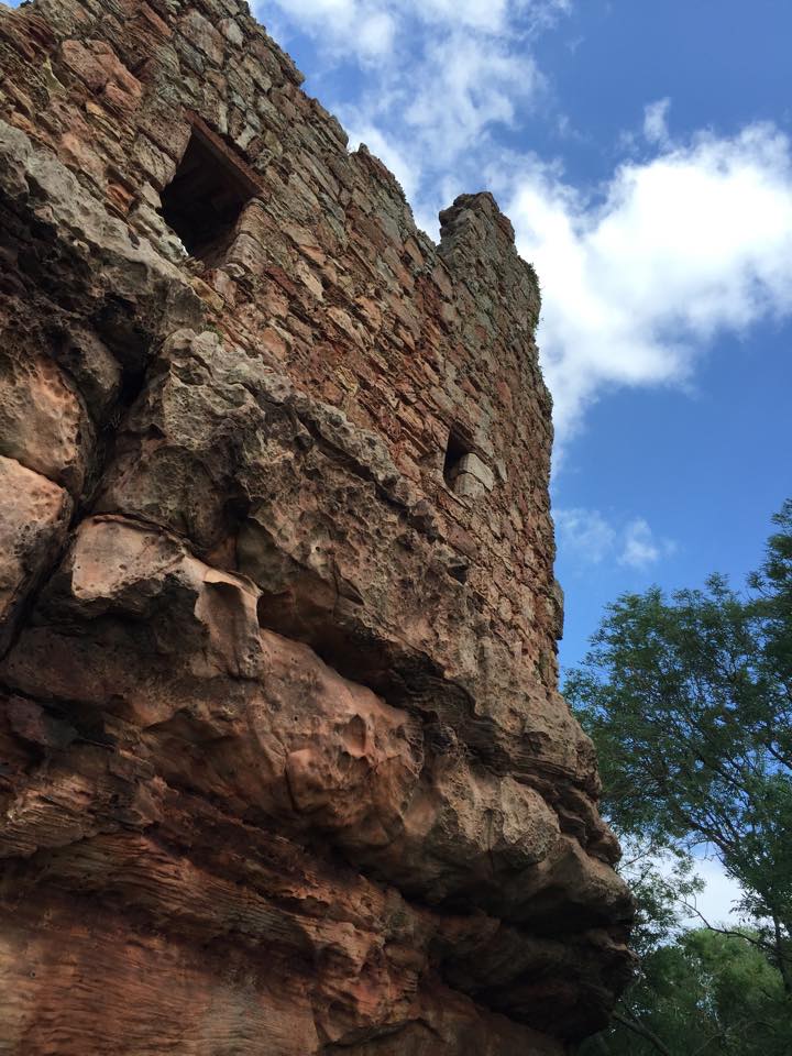
The other print (that I will now call Print #26) looks totally different. Using Google Earth and changing my point of view you can see the two islands in the distance the red arrow indicates Lamb Island and the yellow arrow is Bass Rock. This is a north facing view. Interesting how different the ruin looks from north vs. south. They are from two different engravers and one is dated 1789 and the other 1790. And we have also no idea if the original drawings or paintings that these prints are based on were by the same artists and even when those were made.
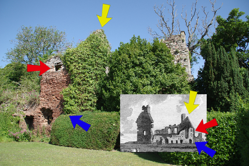
That being said. Look at the wall, the window and the ruined doorways. It’s not perfect but it is damned close. Print #26 – North Berwick Nunnery.

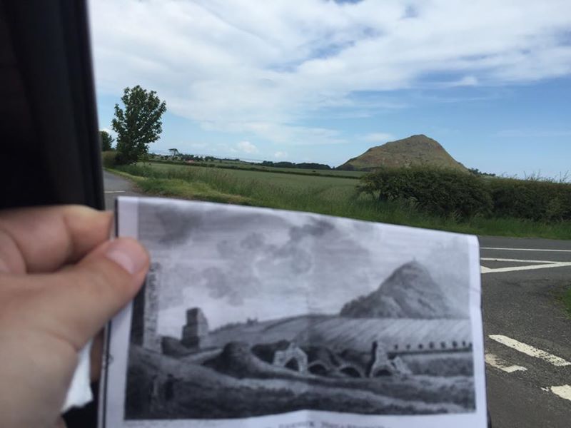
Another long explanation. The volcanic hill is called North Berwick Law. At the top is the ruin of an Iron Age Fortress, which is one of my prints, and a whale’s jawbone.
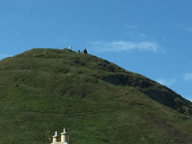
For hundreds of years they would keep replacing the jawbone every time it eroded. Now they use a fiberglass one.
The print is awful – I’ve studied the real layout of the iron age fortress and other photographs and clearly the engraver didn’t understand what the artist had seen. What is worse, to get up that hill is at least an hour and the hike is described as “treacherous”.
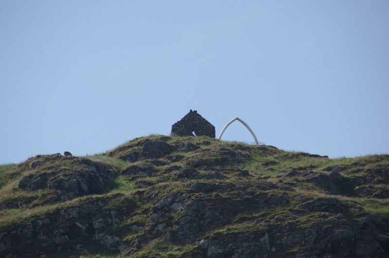
I opted for a long shot with my real camera. Historic #15 – Print #27 – Iron Age Ruin on the Berwick Law.
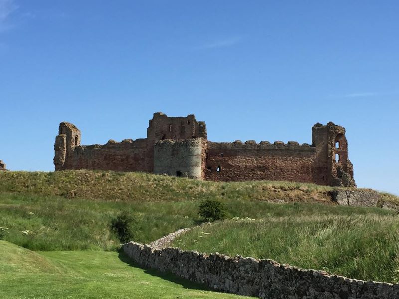
5 minutes away is this epic castle – Castle #59 – Tantallon Castle.
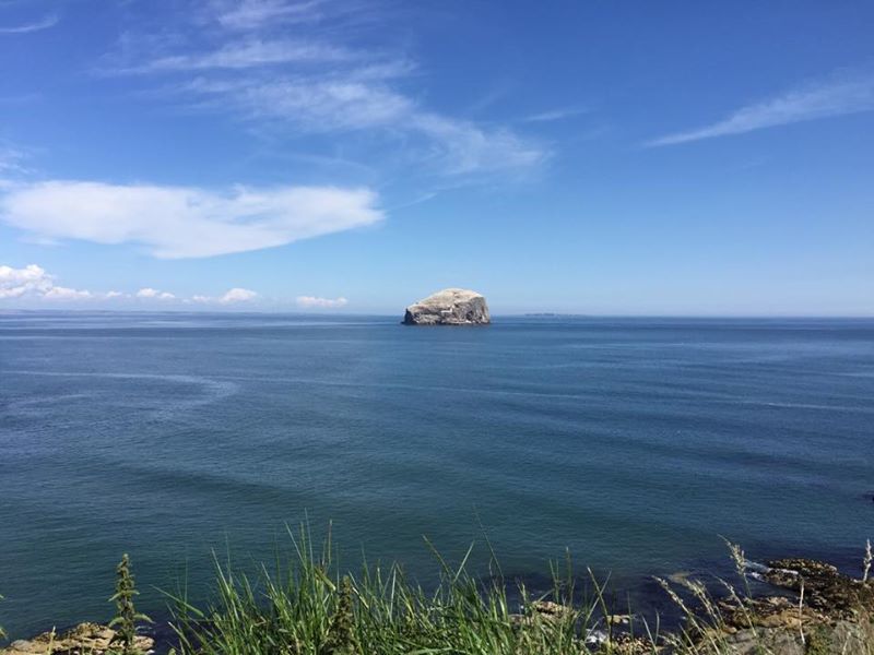
Just gorgeous. The castle has a monastery, a lighthouse, and a bird sanctuary and this view of Bass Rock – Nature #9.
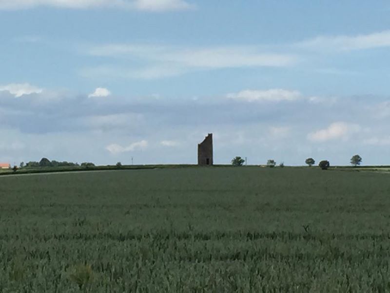
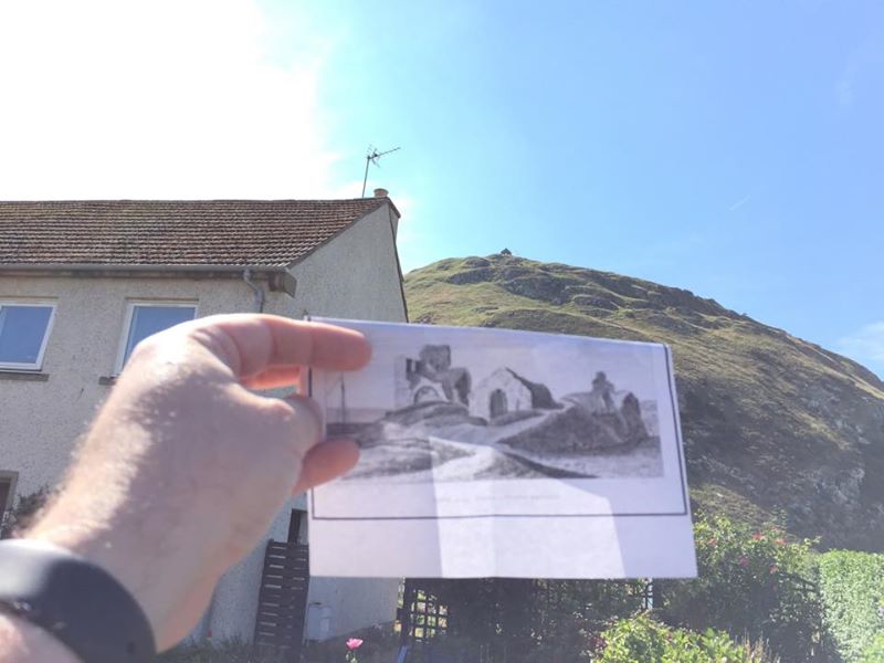
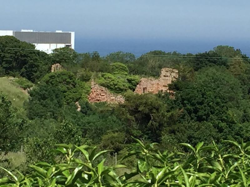
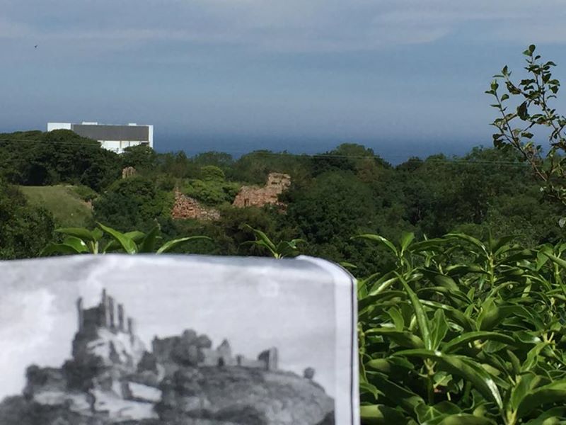
Another detective story. I have been doing extensive research into all ruins in the vicinity of North Berwick in anticipation of these prints. But while I am driving around I see this tower ruin in a field.

I’m thinking there is a tower and field in my North Berwick Monastery print. So I zoom all around at different angles and realize that no matter how hard I look – this isn’t my print.
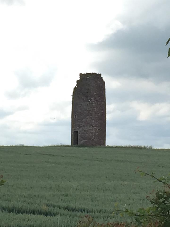
When I came home I found out that it is a Ruined Windmill at Balgone Barns in North Berwick – Historic #16.
I keep driving around and finally it all lines up everything seems perfect – the angle of the ruin, the jawbone at the top, the layout of the fields, the property walls and I am willing to bet this was view of North Berwick Law seen in the engraving. 2018 update: I was wrong. You will have to wait until Day 23 to find out just how wrong though.

However, sometimes it is easy 🙂 I didn’t understand what I was looking at in the print. It just seemed like a bizarre geometry. When I got to the church, the lady there explained that the spire was unfinished, which is why it looks like a hat! Church #25 – Print #28 – Seton Collegiate Church. This is one of my favorite pictures of the trip – a nice happy moment.
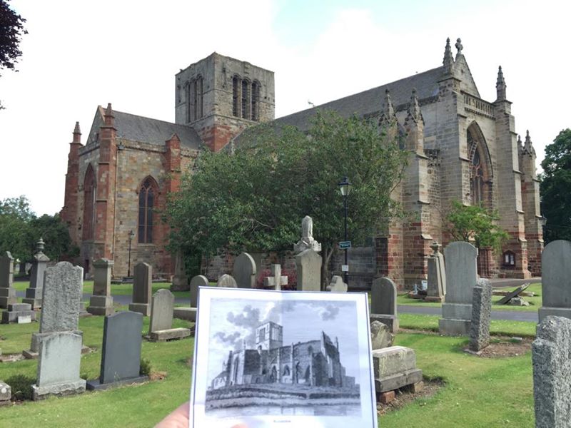
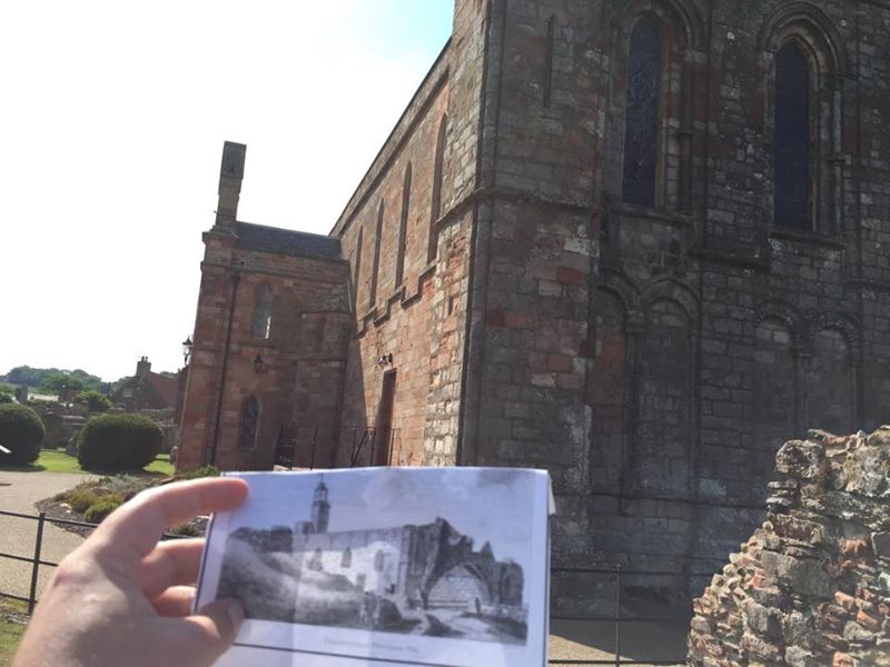
they did a glorious restoration here in the 1970s and the photograph has more than the picture! Church #26 – Print #29 – St Marys Church Haddington.
Um…
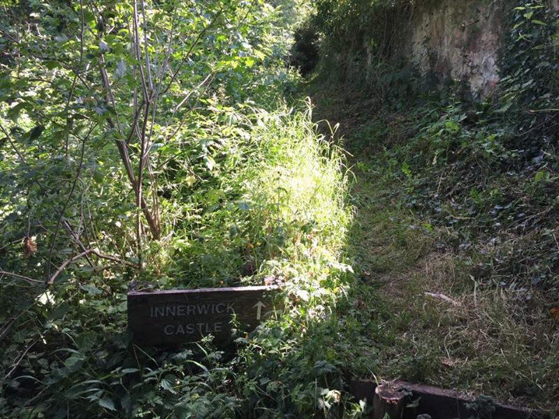
Another challenge. Innerwick Castle is a big ruin that is almost impossible to see via the road or any satellite maps. I found some references to it in a rock climbing website and had a rough latitude and longitude. It overlooks a gulch so you can’t just march around to find it.
I asked at someone’s house and she told me to go to the corner of The 4 Acres farm and a house called “Castleview”. She said once there I could cross into the field and follow the inside of the wall all the way around. I found the corner but I couldn’t see anything. So I decided to ask at the house and climb the stairs to the front door. I am at the top stair and about to knock on the door marked “Castleview” when I turned around and I could SEE the castle. I couldn’t see it from the street, only from climbing up the stairs! Castle #60 – Print #30. It is a big time ruin though – but wait there is even more!
All of the sudden the man who lives in “Castleview” comes out. When I tell him what I am trying to do he informs me that the barley is too high and that all the field shortcuts are gone. He tells me to get back in my car and follow him to Crowhill. He then shows me a gate and a path that leads to the castle from the other side of the gulch!
It starts out normal enough.

Just like a park.
And at least I know I am at the right place!
But it starts to get scary.
And very dangerous.
But I made it and the ruin is massive.
It is amazing how different it is up close.
There is no way to “back up” to take the pictures when behind you is a ravine. I already got my picture from “Castleview”, so technically I didn’t have to trek all the way to it. But but it was too tempting to not finish the hunt and technically I don’t have to do any of this!
I have 3 prints of this church but regretfully all of the interesting bits of the priory are gone!! Church #27 – Coldingham Priory – Print #31.
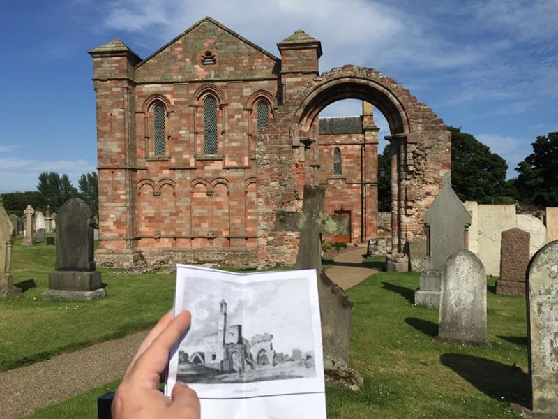
Coldingham Priory – Print #32.
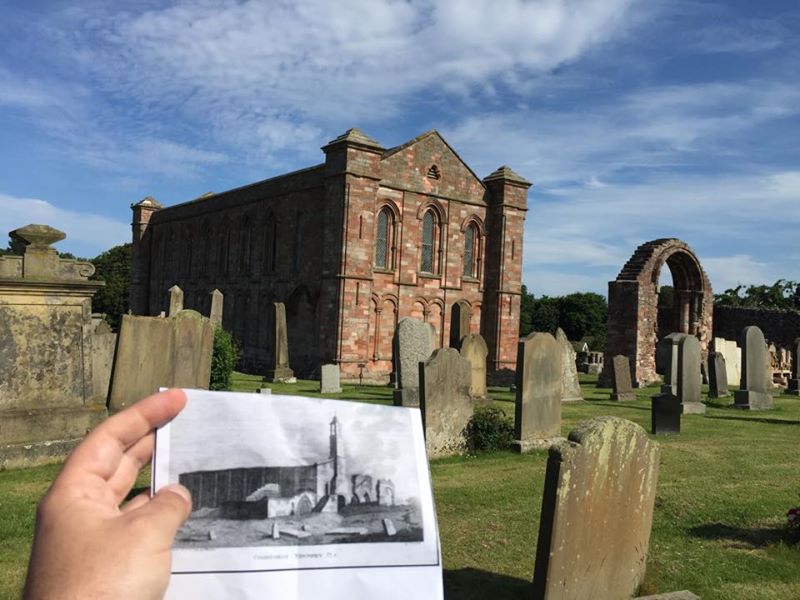
Coldingham Priory – Print #33.

There were like 50 turbines out there.
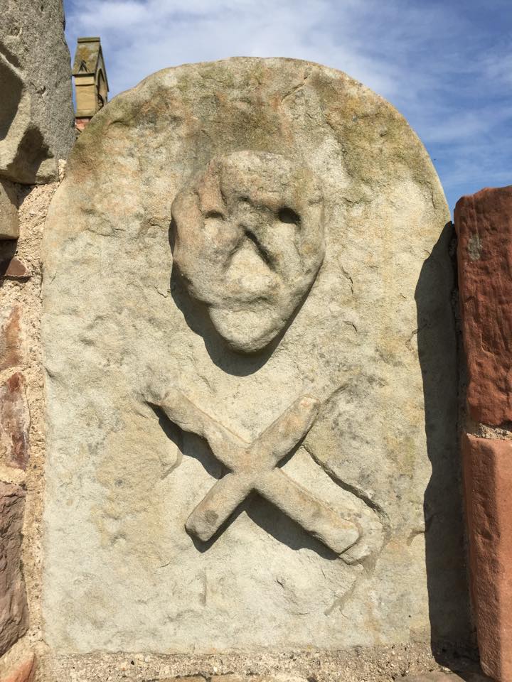
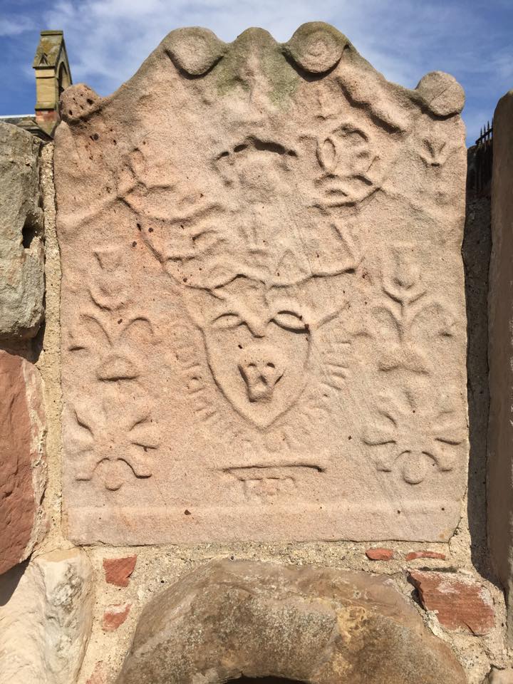
For my tombstone symboligists…
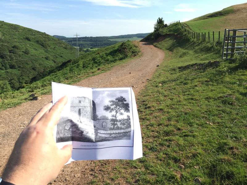
I had one last tricky one on my list – it is just a bizarre coincidence that they are all on the same day! I had coordinates and knew that almost nothing was left of the ruin on my print. After a very long time down/up a truly dirt road and rounding a mountain I came as close as I could but couldn’t find it. I think the ruin was in a field on the other side of that fence that I just couldn’t to safely. I have failed!!! The one that got away! A 2108 update! I’ve been agonizing for years about not climbing that fence or spending more time finding my print: Cockburn Path Tower. I found it online, pictures of the actual ruin and GPS coordinates. So how close was I? Not close at all!

I was 13 miles away!

Insult to injury! The bottom pin is where I “thought” the print was. The top pin is where it actually is. See that blue line? That’s my path. I passed it. I was RIGHT there. I PASSED IT! Well now it really is the one that got away!
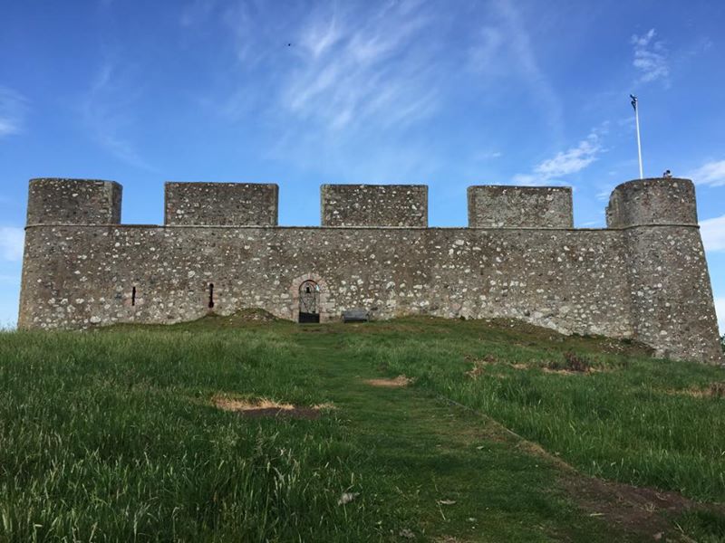
It’s after 5 and everything should be closed. After 5 is my driving time. But look – a Lego castle! Seriously how fake does this thing look! I even went inside. It is very very strange! Castle #61 – Hume Castle.
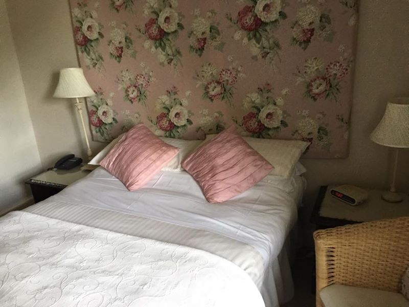
Oh for a good night’s sleep!
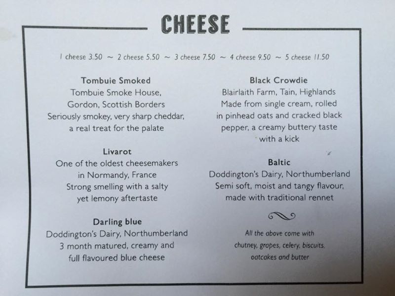
This is a proper cheese course!
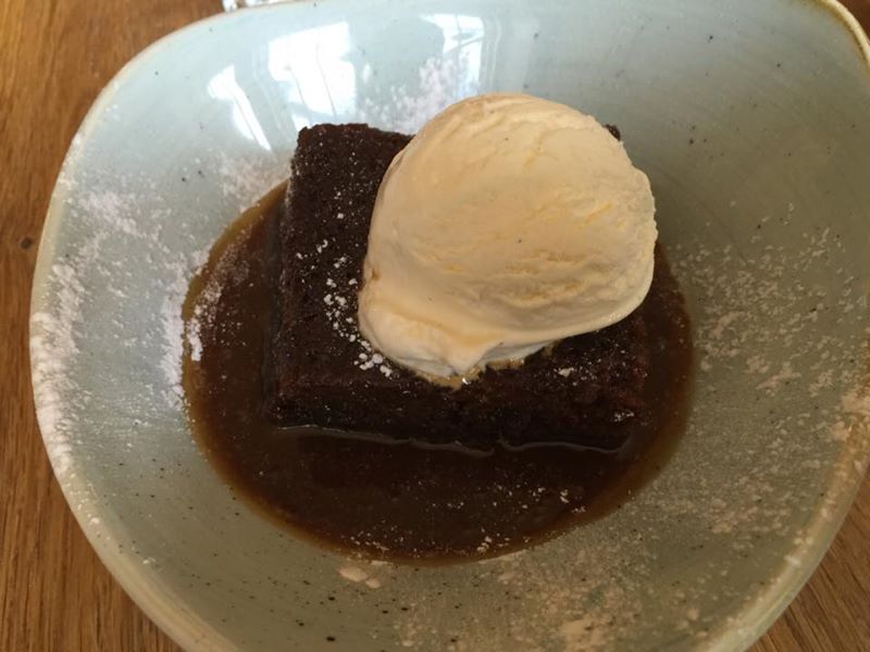
And, of course, I had sticky toffee pudding 🙂
Thus endeth day 19 and what a day! I only have 4 days left – and that last day HAS to be Edinburgh – so I have 3 days to dip down to the southern part of Scotland and and come back up! I’m carefully culling my fun list. Prints are now my highest priority!
Scotland 2015 Totals
Days: 19
Prints: 33
Castles: 61
Churches: 27
Historic: 16
Nature: 10
Prehistoric: 8
Map Day 19: North Berwick to Dryburgh
